Acatenango. If you’re not yet an experienced hiker before attempting the third highest volcano in Central America, this may turn into Acate-no gracias.

Acatenango is not only the third highest volcano in Central America, but also in Guatemala! (Yes, that means the top 3 highest volcanoes in Central America are in mi querida Guate).
My first experience here was vastly different than my return earlier this year. I would now definitely agree that this is one of the best hikes in Guatemala, but I wasn’t so sure my first time around. Ironically, I found my old saved blog post back from 2013 when we attempted this hike with school backpacks, children’s sleeping bags, police escorts and nearly died of hypothermia. (Hey, it’s a great story now, right?). I had a blog titled willtravel4hugs when I lived in Guatemala for 6 months to learn Spanish and I deleted it a few years ago when I started thinking about creating this one. (I almost re-used my old name).
However, my wonderful organized self still had a microsoft word document. So,my friends, for your viewing pleasure, I have decided to post a throwback post. I present to you: 2013 Lizzie. Click here and try not to laugh. My very favorite part is the end because I say at the end that I would be back one day with better gear. And it’s true!
Seven years later, I finally returned. And here we go.
Acatenango Table of Contents
Acatenango Info
Like I said earlier, Acatenango is the third highest volcano in Guatemala and in Central America. It sits at 13,040 feet tall and is considered dormant. The last time that it erupted was 1972, although that was the first time it had erupted since 1927, so who knows. Maybe it’ll erupt in another 30 years.
It’s located about an hour’s drive away from Antigua, the most touristy well-known destination and the second capital of Guatemala (before Guatemala City became the capital).
It sits right next to it’s sister volcano, the beloved Fuego: the main attraction of summiting Volcán Acatenango. By the way, if you see me refer to it as volcán, that is the Spanish word for volcano. Pronounced vohl-kahn, I just can’t say volcano Acatenango too many times without wanting to punch something. Too many o’s, it sounds terrible.
Oh, that reminds me. Acatenango is pronounced Ah-kah-ten-ahngo. Do not use this website: It butchers the pronunciation and I don’t know why it exists.. Check out my latest video to hear me say it correctly and also see my video version of this post! 🙂
Ok, now that that’s out of the way, back to Fuego (Fway-go). Fuego, on the other hand, IS active and almost constantly spews volcanic ash from the top. The reason Acatenango is one of the best hikes in Guatemala is because not only can you potentially see a sunset and sunrise from 13,000 feet (or see nothing like we did in 2013), but you also get to see and listen to Fuego erupting at night. And wow is that beautiful.
I was so thankful we had a clearer experience on my return trip or I may have never attempted this hike again. You can hire just about any tourist company to take you there, or if you are familiar with All Trails, you can attempt to go yourself. It is now popular enough that it is on All Trails. This was not the case when I first went, I only knew of one tourist company that offered it. (Or maybe I was just poorly informed). I personally recommend taking a tour and I’ll tell you why in our experience later in this post.
The hike is about 9 miles round trip, according to All Trails. It’s an all day hike or over night hike for sure (I’d never recommend this as a hike you don’t camp on, although as you’ll see- some tours hike in at night just for the sunrise for a 12 hour hike). It is strenuous in areas.
Because it’s mostly volcanic sand, you find yourself sliding back a little every step. Two steps forward, one step back. (Back to Top)
The Unknown Secret Trail
If you read my post from 2013, you’ll note that the photos seem a bit different than the ones in my experience below. That’s because we didn’t go the way that’s marked on All Trails. The one on All Trails is the tourist trail and the most straight-forward way to get to the top. We went some local-only trail on the other side of the volcano.
I cannot say one way or another if it’s still possible to go this way, especially as a foreigner, so I can’t suggest it here, but I do definitely think that the way we went in 2013 was more more beautiful. I was waiting and waiting in 2020 to come to the “Mirador” and we never passed it.
The view from the Mirador on the “Secret Trail” from 2013
I finally asked someone if they changed the trail and explained to them and they told me I must have gone in the other way.
When trying to find another trail on the map, I had no success. So basically we took a local trail that’s not mapped or well-known and I can’t tell you how to go the way we did in 2013. So sad. It was a really beautiful trail, but if it still exists, only locals can take you and it’s much more dangerous than the tourist trail. Ask some locals, find out if it’s safe. The tourist way is definitely a safe way to go (you don’t need a police escort) nowadays. This is the way we ended up going in 2020. (Back to Top)
My 2020 Acatenango Experience
Because I have had so much hiking experience under my belt now, we decided to go on our own rather than pay for a tour. We bought an uber (yes, they have uber in Guatemala now) to drive us the hour or so from Antigua and drop us off at the trail head.
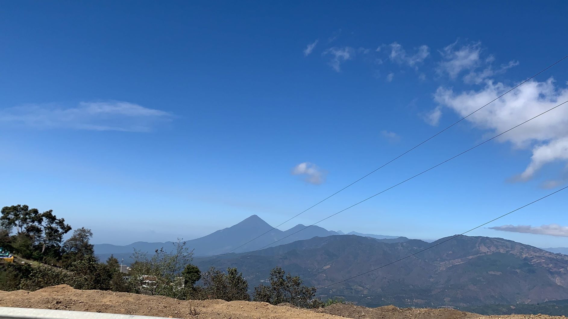
Driving towards Acatenango & Fuego, you can see them in the distance
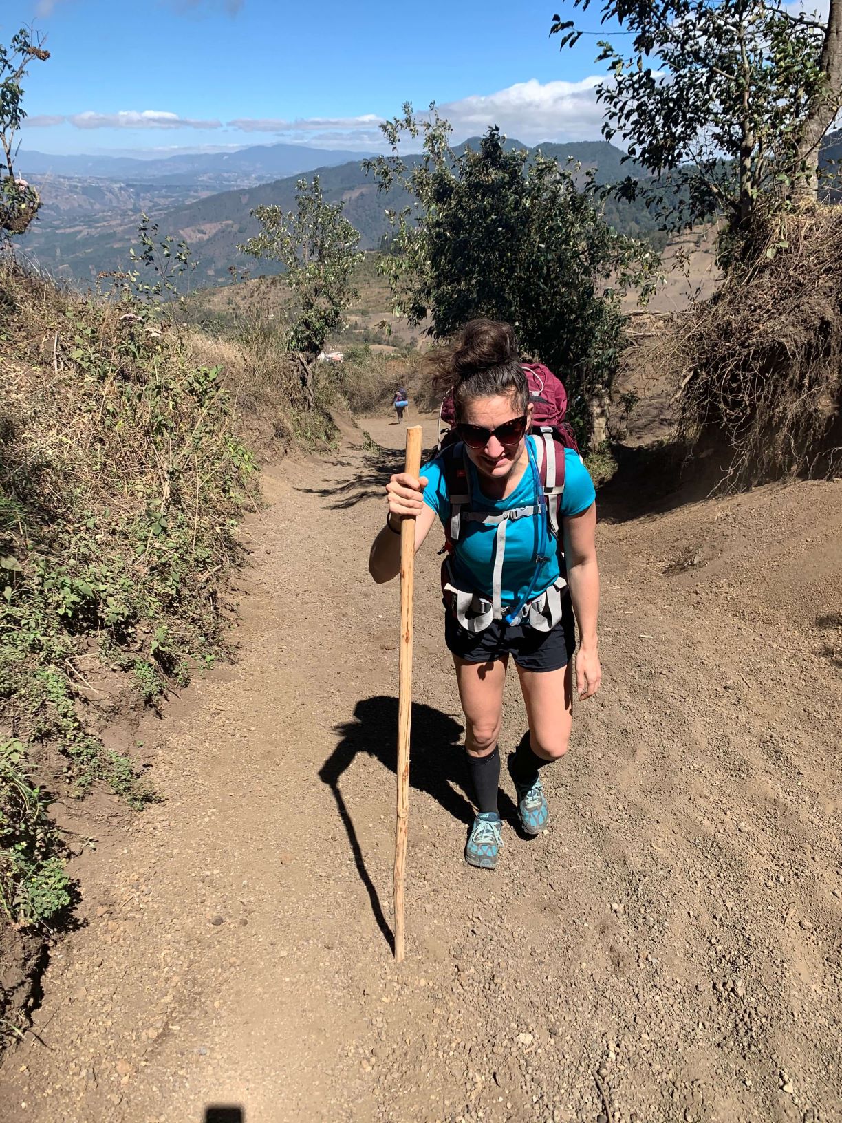
When you get to the trail head, there will be people selling things just like all over Guatemala. You may be used to ignoring them at this point, but don’t. If you don’t have your own trekking poles with you, YOU WANT that walking stick. Trust me. I’m not a big trekking pole user usually, but Acatenango is steep. It’s very helpful. Make sure you didn’t forget your winter gear or you will want to buy some gloves and hats off of them as well.
When we started out, I was shocked at all the people. We were the only ones on the mountain that I ever saw in 2013 and this was packed. It was probably one of my first experiences going on a backpacking trip where that many people were at the start. However, this turned out to be a blessing in disguise as you will read later.
After you hike in a bit, you’ll get to the official park entrance which will charge you 40Q (about $5) per person to get in. (25Q if you’re a Guatemalan). If you go by yourselves, that’s all it SHOULD cost. However, if you get confused like we did, you’ll get charged more for camping in the wrong place.
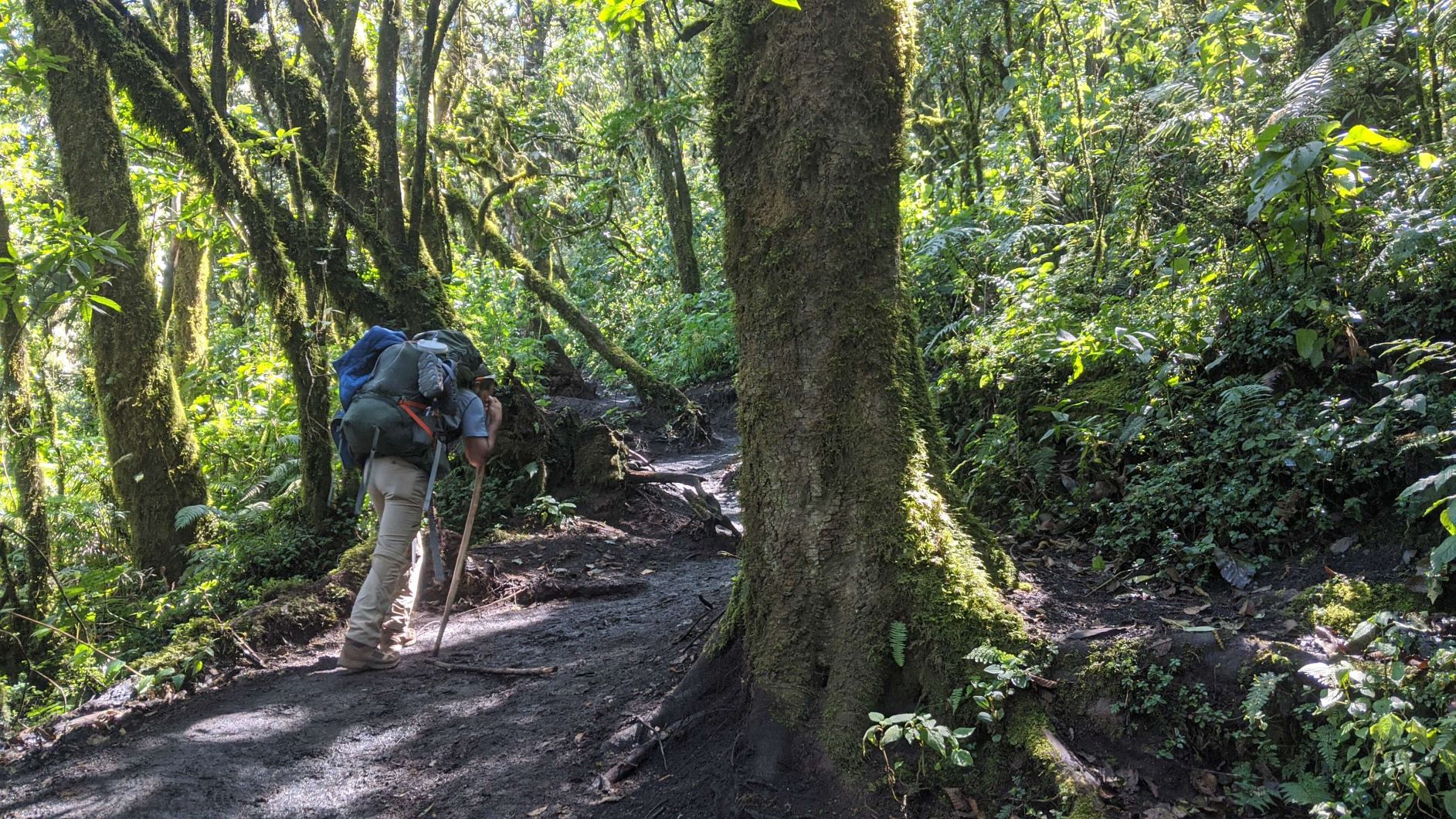
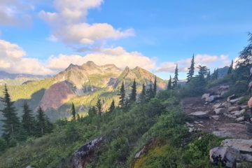
We followed the All Trails map as best we could. The trail itself is pretty straight forward until you get to the camp.
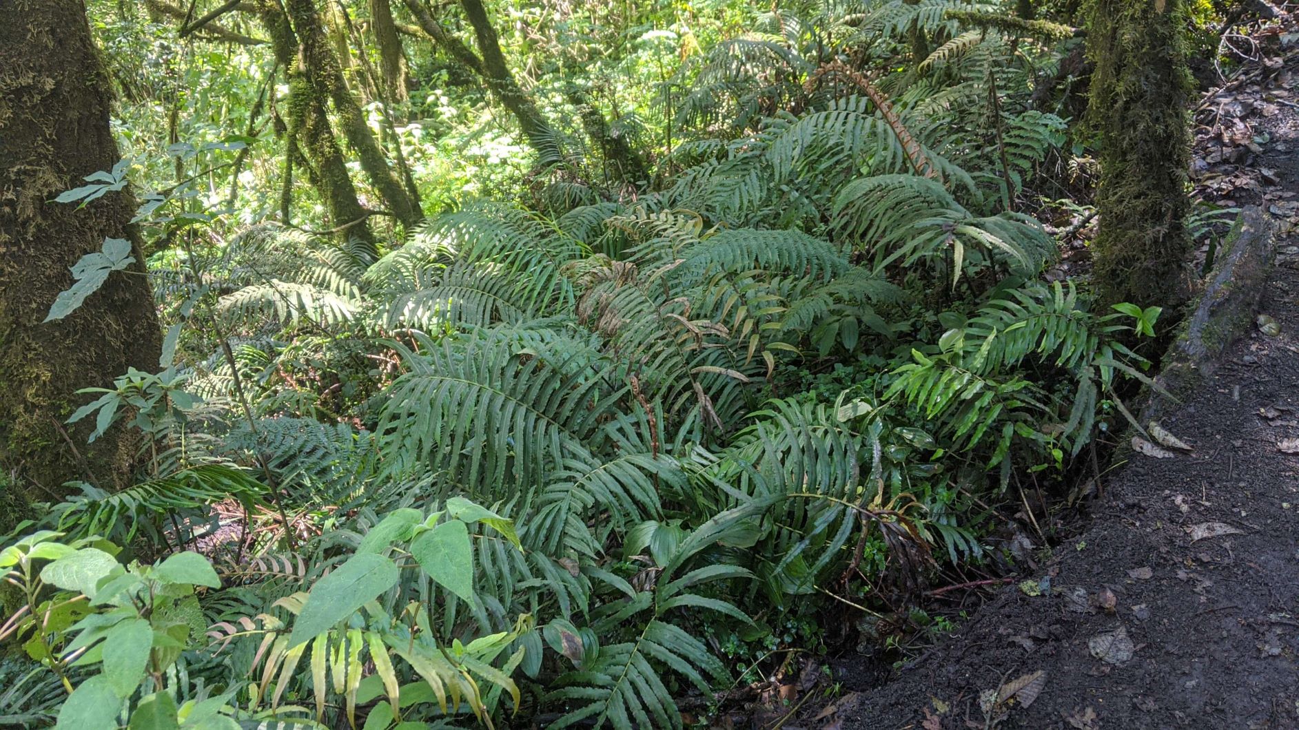
We passed some local houses. We passed my favorite fern forests. We passed some interesting looking trees and some other groups of people.
Then, when you get near the campsites, the trail splits off in so many ways, it gets a bit confusing. We were a little confused where to go to find the campsites and if we hadn’t passed some of the other groups with guides, we would have spent a LOT of time wandering. We found a campsite in the general direction that a tourist guide pointed us to, but thought it was pretty crazy that this was free. It had a shelter, firewood, cooking utensils and a completely flat area set up.
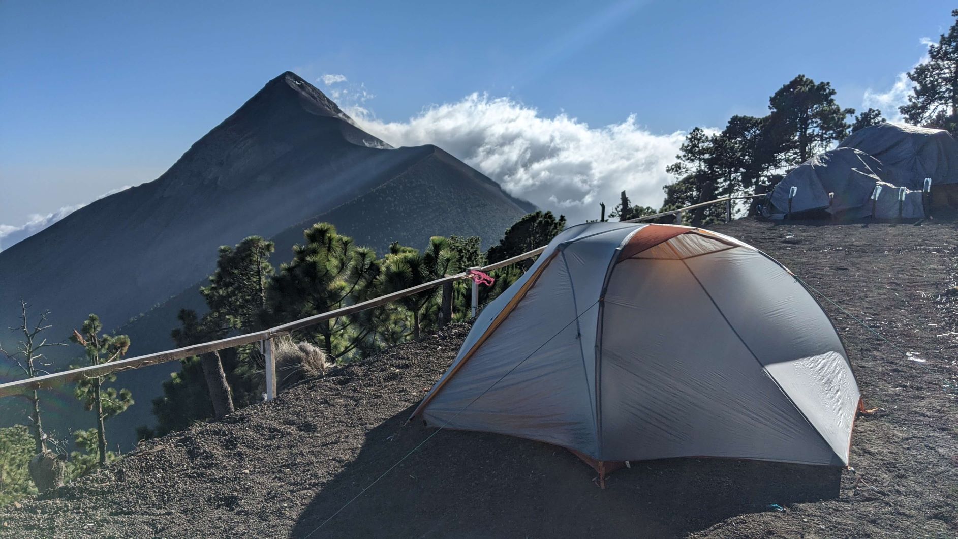
Our set-up on the nice flat campsite
We double checked and they said that it would be fine because that company didn’t have a tour today so it should be okay that we stay there as long as we don’t use their wood (obviously). So we decided to set up camp there. The guide we talked to was very informative and even convinced us out of going to the top for sunset. He said unless the clouds are out and you have to hike to the top to be above them, the view is just as good here. And then you conserve your energy for sunrise.
So that’s what we did. We hiked around looking for a good sunset spot and found one, which ironically turned out to be where the tour group ended up as well. I guess it’s pretty obvious when you find a good spot. It wasn’t an “above the clouds” sunset like I hoped for, but it was still beautiful.
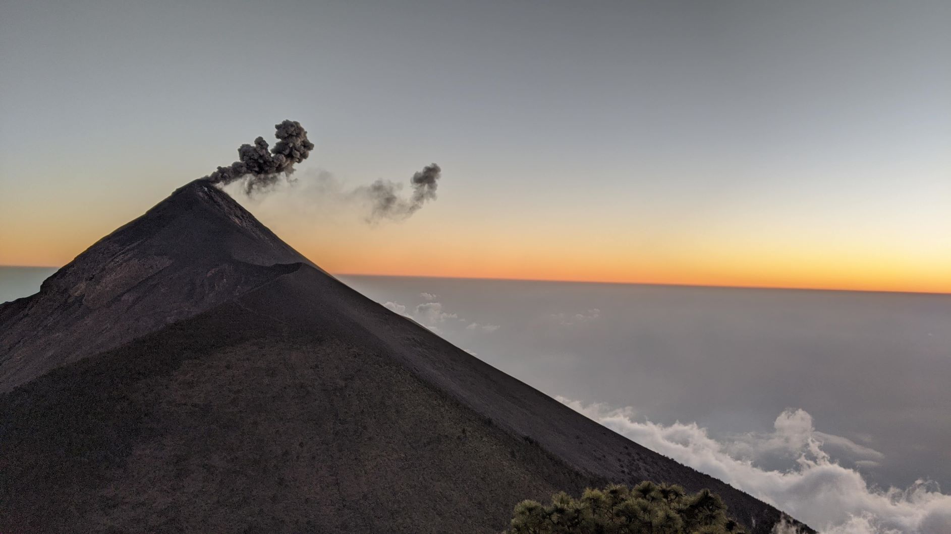
Fuego spewing ashes at sunset
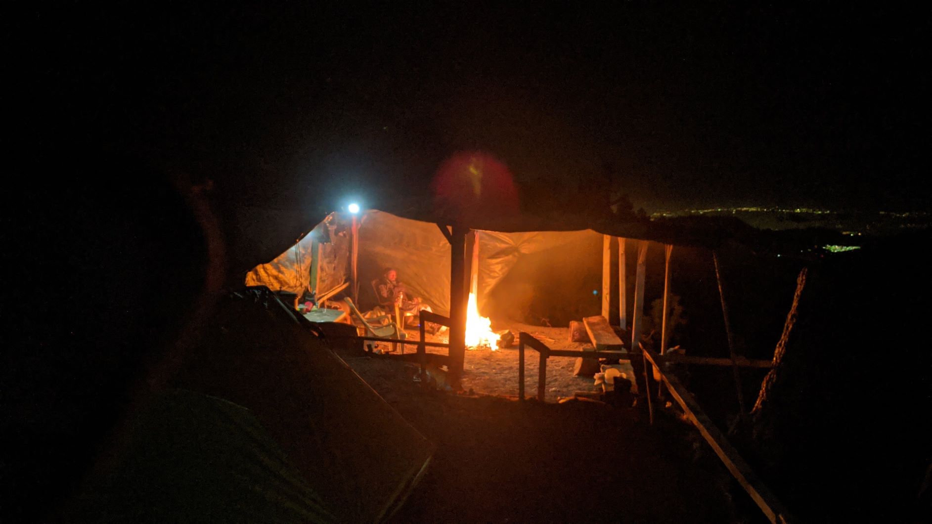
After sunset, we returned to our camping space and we get all set up and comfy for the night with a fire going (that we found our own wood for) and as night settled in, we could see the bright red lava of Fuego. What a magical show! Worth every difficult step to get to the top.
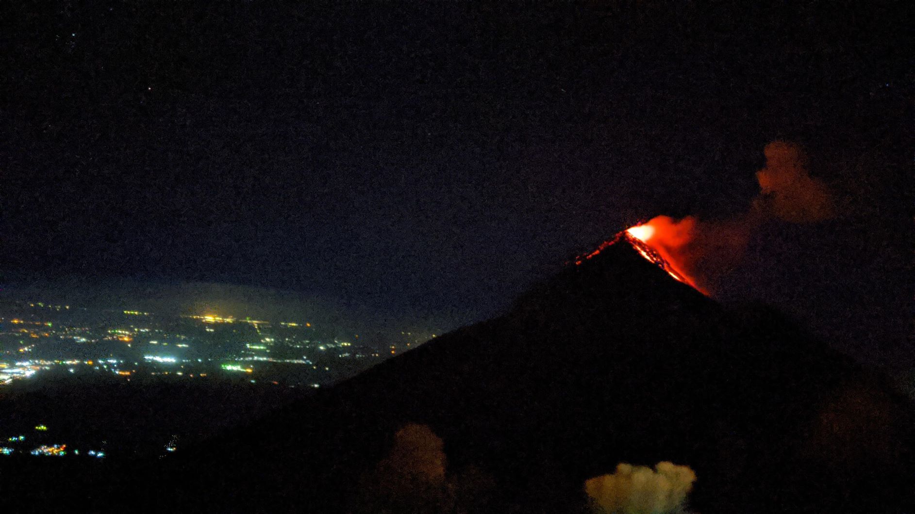
I wish I had a better photo!
Just as we are getting comfy, a guide and two boys walk in at night and say we can’t be there for free. The other guide that said it was okay was wrong. We ended up having to fork over 100Q and found out there are other campsites without such a fancy set up that we could have camped at for free, but we hadn’t passed one and didn’t know what to look for.
We decided it was easier in the dark to just pay the fee since it’s only about $14 and then we got to know the people a little bit and found out they were doing a night hike to Fuego. You can actually hike closer to Fuego and see it erupting up close! Super dangerous, but super cool! It was such a clear night that we could see their headlamps when they were on Fuego. I didn’t have the energy to continue with them and since we didn’t go to the absolute top of Acatenango for Sunset, we hoped to go for sunrise.
The next day, the guide we had met the night before was nice enough to let us tag along to the top of Volcán Acatenango. This is why I mentioned earlier that we were lucky there was so many people going up and also why I recommend going with a guide. Even though we are relatively experienced with backpacking now, it was still a bit confusing at the top. There were lots of ways you can go and unless you’re really experienced at following a compass and a good GPS, it’s easy to get lost.
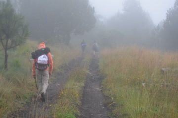
Especially if that beloved fog comes back. We were lucky to have a fairly clear day, but I can definitely see how easy it would be to get lost in the fog. Even in the dark at sunrise, I’m curious if we could have found our way to the top in time had we not been with a group. One section was very sketchy with the wind. We were glad we hadn’t attempted to camp at the top because thinking about wearing our backpacks at that point was a little scary.
It was extremely cold and windy at the top. I could only stand to take one or two photos before I was balled up trying to stay warm. The sunrise was okay, we didn’t get one of those nice cloudy pink sunrises, but I was super happy I had finally made it to the top of Acatenango 7 years later.
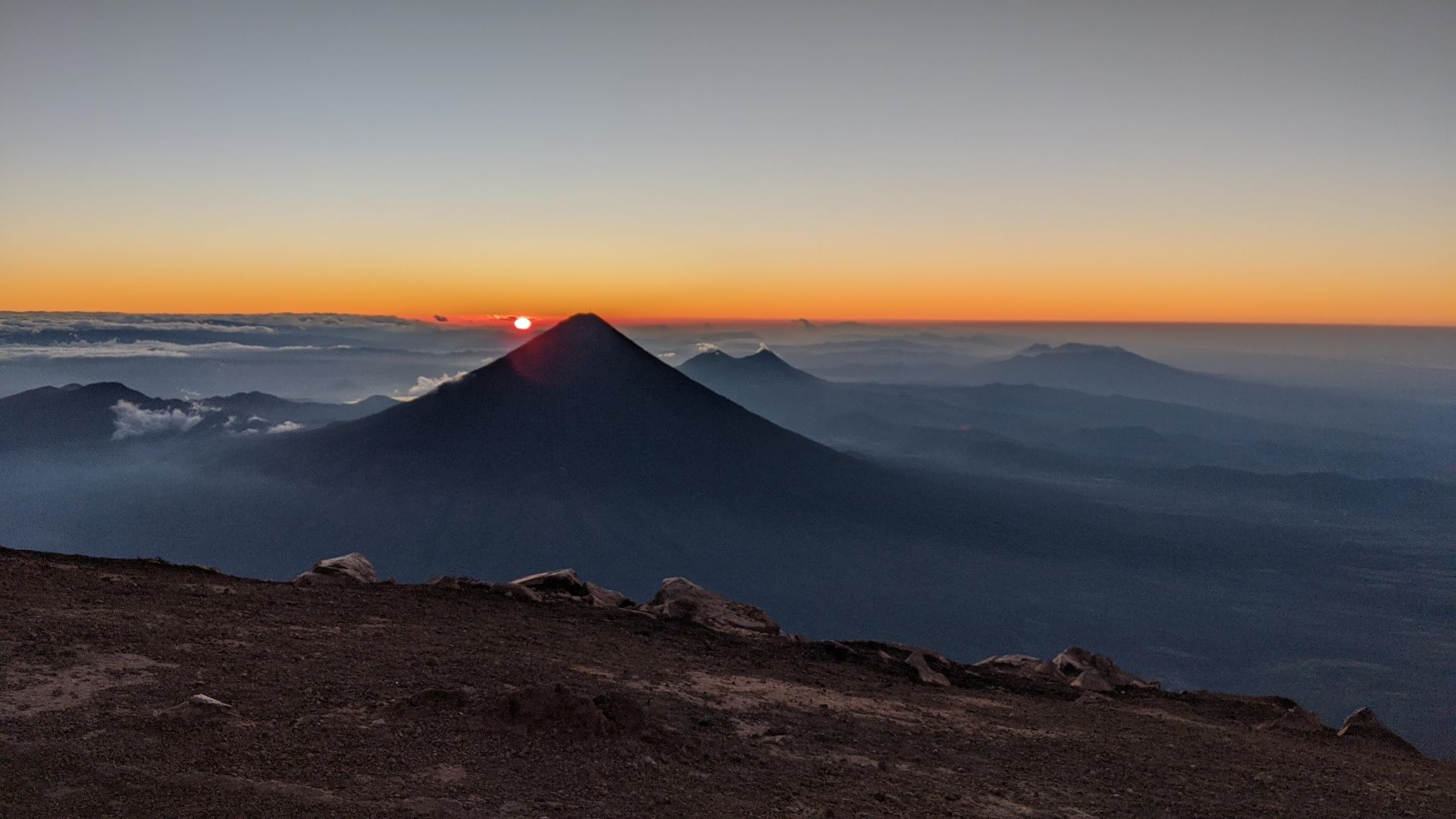
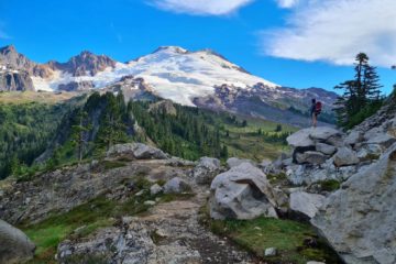
Sunrise from the top of Volcán Acatenango
My experience in 2020, as you can see, was completely different than 2013. It was mostly clear (except for the cloud forest everyone goes through on the hike up), we had actual backpacking gear, I’d done several backpackng trips before this, and we got to see sunrise and sunset and Fuego. It was still an exhausting hike, but way less so with the proper gear. I never would have made it to the top and back alive in 2013.
I have no idea how high we got or how close we got in 2013 because all you could see was fog, but I know I was dead afterwards. I was still pretty tired in 2020, but I didn’t need 14 hours of sleep and I also went farther and with heavier equipment.
It’s definitely one of the best hikes in Guatemala and worth the effort. Definitely one of my favorite places to see and if you have the energy, go all the way to Fuego! (Back to Top)
My recommendations for One of the Best Hikes in Guatemala
You kind of see that I was hinting that it may be better to go with a group in our experience. We were trying to save money and because it’s so popular, you may get lucky like us and find other people to talk to and follow, but to be safe, it’s better with a guide.
Without a guide, if you’re desperate to save money AND consider yourself a very experienced backpacker AND if you do EVERYTHING correctly and don’t end up in a tourist agency-owned campsite, it should only cost you your equipment and food, plus the $5 to get in and the $20 ($40 round trip) uber or $1 bus ride if you know which buses to take from Antigua.
Note: YOU WILL NOT LIKELY FIND AN UBER FROM ACATENANGO TO ANTIGUA. We established a relationship with our Uber driver (speak spanish!) and asked for our guy’s phone number so he could come back and pick us up if we needed and offered to pay him directly (so he doesn’t have Uber take a fee).
YOU MUST know Spanish if you are planning to attempt this cheap route. We took an uber there and took a bus home. Note that on the buses you do run the risk of being robbed, but I have so far not encountered such an experience. I just stay with my backpack. We even ran into another backpaker! We figured if we got robbed on the way back, we can buy new gear, but to be safe on the way to the volcano because we needed our gear for the hike!
What I actually recommend is taking the tour regardless. Why? Because it only costs 350Q (pre-pandemic prices. Prices are subject to change). That’s roughly $45. It includes food, a guide, a shuttle to and from the volcano. It does not include your entry fee ($5). So $50 total includes your shuttle, your nice campsite, your entry, and your food! It’s a pretty awesome deal, especially if you were considering taking uber both ways. That would have cost about $40 alone!
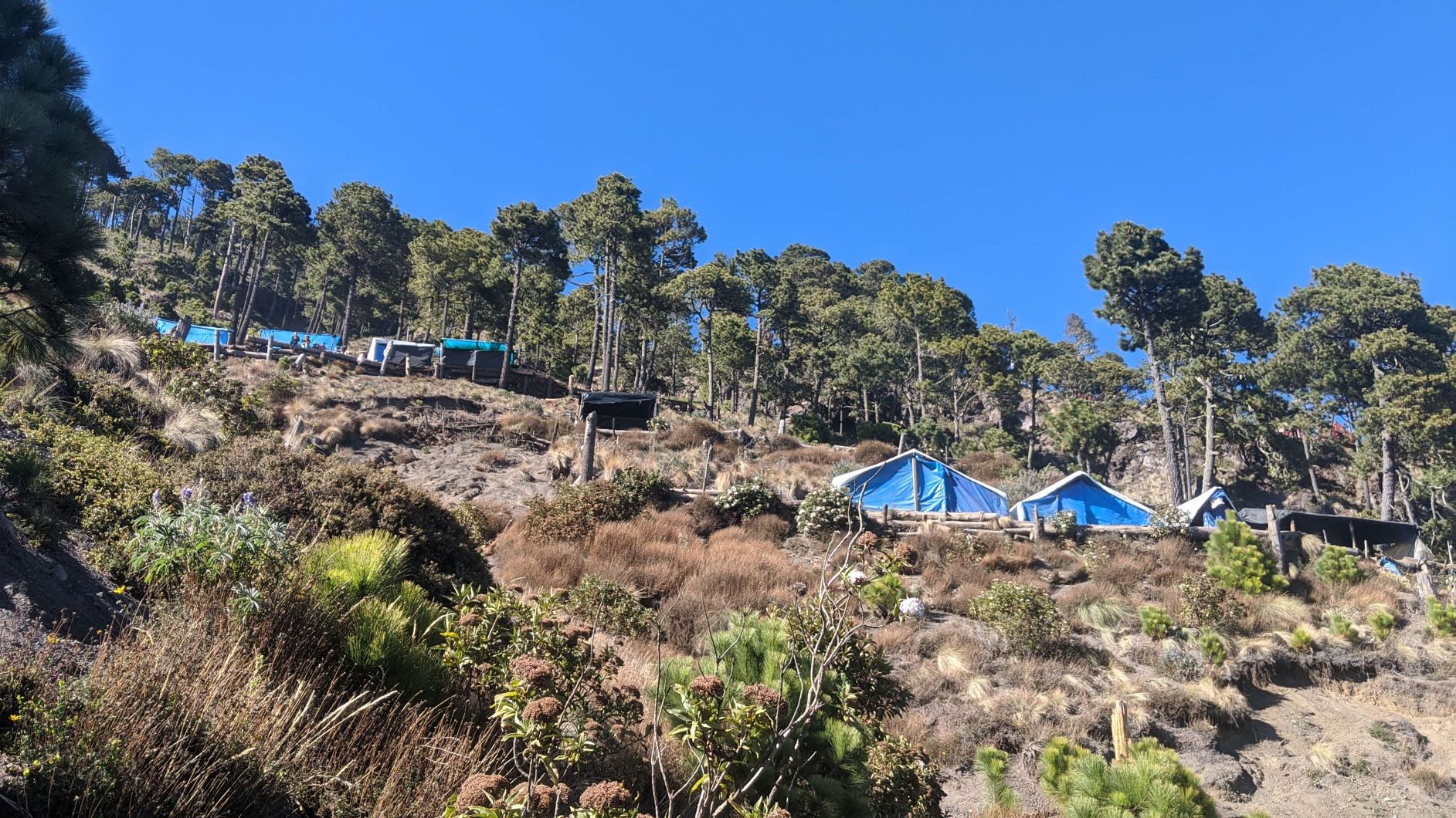
Some of the campsites owned by tourist agencies
Obviously if you’re super adventurous and speak Spanish, you could potentially go for under $10 (after buying your camp stove fuel and food), but run the risk of getting robbed on the bus or lost on the trail or end up paying a random 100Q for ending up in the wrong site and you also have to find your own firewood, which can be a challenge on a nearly barren volcano.
Also, with a tour, you get the chance to meet a bunch of other people from other countries and states and it’s an overall much more exciting experience! The guides usually have a lot of fun stories to share and it’s super nice having your food and fire made for you.
Every tourist spot has a nice little shelter for gathering and having a fire
Lastly, I want to remind you that tour guides know more about the weather. As you can see in my 2013 experience, weather is important. You want to at least have some idea of what to expect. If you read through some of the comments on All Trails, it can get pretty crazy up there! Our guide had lots of stories about it and for me, just the wind and cold that we had was enough. If you watched my Youtube video, you’ll hear that wind.
The best time of year to go is during the dry season which is from December to April. In the wet season, which is when I went in 2013, you’re increasing your risk of bad weather and you do NOT want bad weather up there.
Although Acatenango is one of the best hikes in Guatemala and I highly recommend it, it is NOT an easy hike. Do not attempt this without the proper research and do not hire locals who aren’t with tour agencies (unless you liked my 2013 experience).
You need to make sure you bring enough water, as you will not find any water sources on this hike. This is one of the reasons why Acatenango is such a challenging hike because you will need a lot of water at this altitude and climate, but there’s none available on the trails. It was difficult carrying in enough water, as water is the heaviest item. However, extremely necessary.
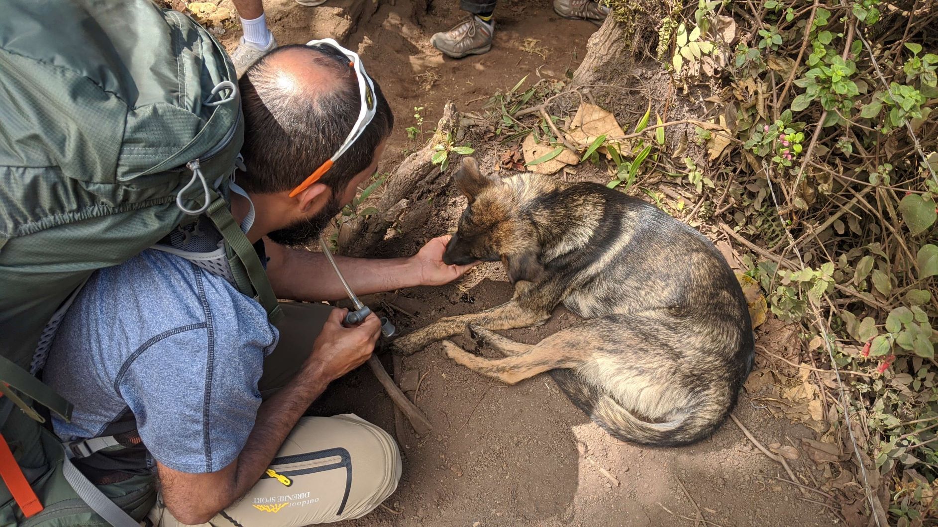
We even found a dehydrated dog who looked in real bad shape until my friend gave him some of his water!
Being that it sits next to an active volcano that you can actually add to your tour, you can see that this is potentially very dangerous hike. If you choose to go alone and don’t see anyone on the trail, you may want to reconsider and turn back and find out why no other groups are there!
OR just fork over the $50 and go with a reputable tour agency to have the best experience. Be prepared for incredible views and a whole lot of cold. As much as my 2013 experience is a really cool story now, I do not recommend having an experience like that for anyone. Any worse and I might not be here today telling you this story!
Enjoy and stay safe! (Back to Top)
Gear I took with me on this hike:
This list of gear is almost the same as the list that I took to Gothic Basin in Washington, but since I went with a friend, we shared his tent. I also had not yet bought my current Nemo sleeping pad or Samsung Galaxy s20.
- Google Pixel 2XL
- REI Half Dome 3p (no longer sold)
- Nemo Hornet Footprint
- Nemo Disco Sleeping Bag
- Sea-to-Summit Bag Liner
- Nanopuff Puffy Jacket
- Altra Superior Trail Runners
- Black Diamond Spot 350 Headlamp
- Black Diamond Zip Lantern
- Platypus Evo 3L Hydration Bladder
- Smartwool Zip Top 250 Midweight Base Layer
- Helly Hansen Rain Jacket
- a lacrosse ball for in-hike massaging
- Ultima Replenishers Electrolyte Powder
- KT tape
- Moleskin
- REI sock liners
- Compression socks
- Smartwool socks
- Trowel & toilet paper/trash bags
- a generic pair of sport shorts, a tank top, & sports bra
- some winter pants found on Wish (link for similar product)
- food
- odor proof bags
- anti-critter bag
- first aid gear (see first aid post
) - Quechua 50L Backpack (no longer sold- link is to updated version)
Please note that the gear I took for this overnight hike will be different than what I suggest for a day hike. If you want to know what to bring for a day hike, go here.
0 Comments